Kategorie
Audiobooki
Czasopisma
Ebooki
Fantastyka
Komiksy
Książki dla dzieci i młodzieży
Książki do nauki języka obcego
Książki obcojęzyczne
Kultura i sztuka
Literatura faktu, reportaż
Literatura piękna
Naukowe, popularnonaukowe
Podręczniki
Podróże, mapy, przewodniki
Poradniki i albumy
Pozostałe
Thrillery, sensacyjne, kryminały
Inne
E-czytniki i tablety
Filmy
Gadżety i akcesoria
Gry i zabawki
Kalendarze
Muzyka
Zestawy i pakiety
E-prasa
Gazeta Wyborcza PDF 2024-06-28
Cena: 2.00zł
Prenumerata: 1.13zł

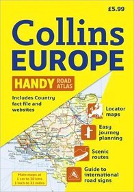
Collins Handy Road Atlas Europe
4.00
Oceń książkę!
Autor: ...
Wydawnictwo: Harper CollinsISBN: 9780007364138
EAN:
Format: ...
Oprawa: ...
Stron: ...
Data wydania: ...
Gdzie kupić tanią książkę?

książka
32.00zł
Książka w Twoim domu w ciągu 48h
Książka "Collins Handy Road Atlas Europe"
Nasza księgarnia internetowa to książki, podręczniki największych księgarń oraz wydawnictw zebrane w jednym miejscu.
To my przekierujemy Cię do ksiegarni, która oferuje aktualnie najtańsze książki w internecie.
mKsiegarnia.pl - Przekierowujemy do najtańszych księgarń w Polsce!
Copyright © mKsiegarnia.pl - Porównywarka Cen Książek
Copyright © mKsiegarnia.pl - Porównywarka Cen Książek